Example of a Channel Landform:
The channel picture or map is of the English Channel, UK
A channel is a waterway that lies between 2 landmasses, connecting 2 bodies of water.
A channel has sufficient width and depth for boats or larger vessels to pass. A channel can also be a specific route through a body of water to guarantee sufficient depth for passing vessels.
Various geological process can help to create a channel. A change in water level can sometimes create or remove a water channel, depending on land conditions above and below the water. A channel can be artificially built to connect two bodies of water.
As a route through a body of water for passing vessels, a channel can be created or maintained by removing material from the bottom of the route for passage.
A channel can be found on any body of water between land masses where there is enough room for boat traffic.
A channel can be large enough for small boats to pass, or many miles across, permitting ocean going vessels to pass safely.
Ambrose Channel, New York City, USA
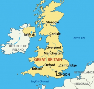
The English Channel, UK
Strait of Gibraltar
The Ambrose Channel is the main shipping channel that leads into New York Harbor. It is a route through the water whose depth is maintained so that vessels can enter safely. The English Channel separates the United Kingdom from the coast of France and mainland Europe.
It begins at the Atlantic Ocean and passes eastward, south of the English Coast. At the east end it narrows at Dover’s Strait and then opens toward the North Sea. The channel is 350 miles long and 150 miles wide at its widest point. At Dover’s Strait, it narrows to only 20 miles in width.
The word “strait” also means a waterway between two land masses. The strait of Gibraltar is a channel that connects the Mediterranean Sea to the Atlantic Ocean between the southern tip of Spain and Morocco in northern Africa. The strait is only 7.7 miles wide and was a strategic location during wartime, controlling passage in and out of the Mediterranean Sea.
A waterway that passes between two land masses, connecting two bodies of water and permitting the passage of boats or larger vessels
We want pictures and location of the lanforms around the world and we need your help. Click get started button below.

In Asia, China, India, Nepal, and Bhutan are home to one of the eight wonders of the world and one of the most beautiful mountains in the world, the Himalaya Mountains also called the Himalayas. Boasting as the world’s highest and most famous mountain peak, Mt. Everest. Within the verse of the ‘Kumarsambhava’, Sanskrit […]

Nature have provided us with fascinating landforms and features. The most often adored landforms are volcanoes. Like the perfect cone structure of Mayon Volcano in the Philippines or Mount Fiji in Japan, people look at their beauty and wonder with great appreciation to nature. Volcanoes are mountains with a very disastrous nature. Their only […]

Taal Volcano is the second most active volcano found in the province of Batangas. A complex volcano in the middle of Taal Lake and is often called an island within a lake, that is an island within a lake that is on an island as well as one of the lowest volcano in the […]

Mayon Volcano is one of the active volcanoes in the Philippines. Located in the southern part of Luzon about 473 kilometers (294 miles) from Makati Business District of the Philippines, Mount Mayon is the main landmark of the Province of Albay of Bicol Region. According to local folklore, the volcano was named after Daragang […]

The global temperature and weather is to a large extent a direct result of the sun’s effect to our planet. Together with the atmosphere and the rotation of the earth on its axis. The earth on which weather moves on has its own effect on the weather. The different landforms like mountains, volcanoes, plains, and the […]

