Example of a Cuesta Landform:
Ondondaga Formation, New York State and Ontario
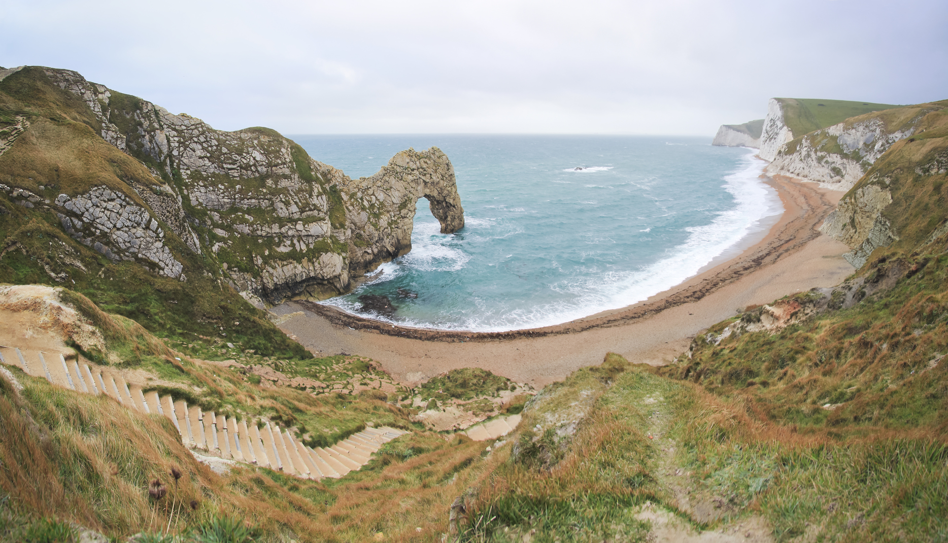
The cuesta picture above is of Jurassic Coast in Dorset, UK. It also has a natural arch.
A cuesta is a gently sloping ground formation that has a cliff or steep face dropping from the upper edge. Two or more of these may sometimes occur one after another, running parallel over an area of land.
Alternating layers of hard and soft rock can slope gently upward, eroding at the upper edge to form one or more cuestas in the ground. At the higher edge of the formation, soft rock erodes more easily than the hard rock layer above, forming a cliff or steep bank. The sloping formations are usually covered by soil and vegetation, and the rocky cliff or embankment may be exposed in some areas. In the desert, more of the rock formation may be exposed.
A cuesta can be just 20 feet wide to the upper edge and steep face below for example, or as much as a mile or more, depending on the slope and the height of the ridge or steep face dropping from the upper end of the formation. The length of a cuesta formation can be a few hundred feet or several hundred miles long.
Cuestas can be found in some plains regions. They occur more often near an ocean or large body of water.
Ondondaga Formation, New York State and Ontario
Jurassic chalk White Horse Hills, UK
Cotswolds, UK
Côte d’Or and Côtes du Rhône regions of France
As part of the Onondaga Formation, In a portion of central and western New York State, a cuesta formation runs from the Hudson River westward across the state, passing the northern end of the Finger Lakes and to the city of Buffalo. The steep face of this formation is prominent in some areas and less visible in others.
Another cuesta formation of the Onondaga runs east and west through Ontario from Fort Erie to Windsor. In the coastal plains region of Texas north of the Gulf of Mexico there are multiple cuesta formations that lie parallel to the coast. Jurassic chalk White Horse Hills, UK, correct name, location and dimensions. Cotswolds, UK, correct name, location and dimensions.
The Côte d’Or and Côtes du Rhône regions of France are wine-growing country that have significant cuesta formations.
A gently sloping formation with a cliff or steep face below the upper edge
We want pictures and location of the lanforms around the world and we need your help. Click get started button below.

In Asia, China, India, Nepal, and Bhutan are home to one of the eight wonders of the world and one of the most beautiful mountains in the world, the Himalaya Mountains also called the Himalayas. Boasting as the world’s highest and most famous mountain peak, Mt. Everest. Within the verse of the ‘Kumarsambhava’, Sanskrit […]

Nature have provided us with fascinating landforms and features. The most often adored landforms are volcanoes. Like the perfect cone structure of Mayon Volcano in the Philippines or Mount Fiji in Japan, people look at their beauty and wonder with great appreciation to nature. Volcanoes are mountains with a very disastrous nature. Their only […]

Taal Volcano is the second most active volcano found in the province of Batangas. A complex volcano in the middle of Taal Lake and is often called an island within a lake, that is an island within a lake that is on an island as well as one of the lowest volcano in the […]

Mayon Volcano is one of the active volcanoes in the Philippines. Located in the southern part of Luzon about 473 kilometers (294 miles) from Makati Business District of the Philippines, Mount Mayon is the main landmark of the Province of Albay of Bicol Region. According to local folklore, the volcano was named after Daragang […]

The global temperature and weather is to a large extent a direct result of the sun’s effect to our planet. Together with the atmosphere and the rotation of the earth on its axis. The earth on which weather moves on has its own effect on the weather. The different landforms like mountains, volcanoes, plains, and the […]

