Appalachian Escarpment, eastern USA
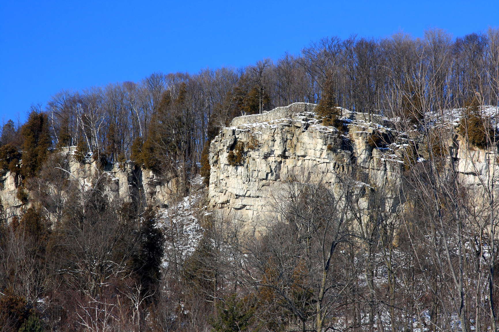
The escarpment picture above is of a Niagra cliff in New York.
A long cliff or steep slope forming the edge of an elevated portion of land is called an escarpment.
Faults can occur between two areas of land, as a result of geological forces that may raise one area above the other. At the fault line, the raise portion of land may form a cliff or other steep formation along its edge. An escarpment can also be formed by erosion of a soft rock layer by the action of waves along a shoreline or flooding of inland areas. Where more than one layer of rock is exposed, soft rock formations that lay below a hard rock layer may erode to form an escarpment.
An escarpment is much longer than the height of the formation. It can be from a few dozen feet long to hundreds of miles in length.
Escarpments can be found where fault lines occur, forming an elevated portion of land on one side. They can also be found overlooking a body of water, or a plain or valley that held a body of water in the past.
• Appalachian Escarpment, eastern USA
• Jebel Tuwaiq, Arabian Peninsula
• Great Escarpment, Australia
• North Downs, Surrey and Kent, UK
The Appalachian Escarpment is the eastern edge of the Appalachian Plateau that stretches from New York State all the way to Alabama. Due to much erosion of the plateau, it looks more like a mountain range when viewed from the coastal plain. Jebel Tuwaiq is a 500 mile long escarpment in the central Arabian Peninsula and is part of a cuesta formation.
The eastern side is a gradual slope, while the western edge forms an escarpment, a cliff averaging 370 feet in height. The Great Escarpment in Australia lies east of the Great Dividing Range and runs north and south through most of the eastern portion of Australia. The escarpment forms the eastern edge of a plateau that begins at the Great Dividing Range. Erosion and geological forces have both played a part in its formation, beginning about 80 million years ago.
In the counties of Kent and Surrey of southeast England in an area that is known for its natural beauty lay the North Downs. A steep escarpment overlooks the coast at more than 600 feet above sea level.
The edge of an elevated portion of land, forming a long cliff or other steep formation
We want pictures and location of the lanforms around the world and we need your help. Click get started button below.

In Asia, China, India, Nepal, and Bhutan are home to one of the eight wonders of the world and one of the most beautiful mountains in the world, the Himalaya Mountains also called the Himalayas. Boasting as the world’s highest and most famous mountain peak, Mt. Everest. Within the verse of the ‘Kumarsambhava’, Sanskrit […]

Nature have provided us with fascinating landforms and features. The most often adored landforms are volcanoes. Like the perfect cone structure of Mayon Volcano in the Philippines or Mount Fiji in Japan, people look at their beauty and wonder with great appreciation to nature. Volcanoes are mountains with a very disastrous nature. Their only […]

Taal Volcano is the second most active volcano found in the province of Batangas. A complex volcano in the middle of Taal Lake and is often called an island within a lake, that is an island within a lake that is on an island as well as one of the lowest volcano in the […]

Mayon Volcano is one of the active volcanoes in the Philippines. Located in the southern part of Luzon about 473 kilometers (294 miles) from Makati Business District of the Philippines, Mount Mayon is the main landmark of the Province of Albay of Bicol Region. According to local folklore, the volcano was named after Daragang […]

The global temperature and weather is to a large extent a direct result of the sun’s effect to our planet. Together with the atmosphere and the rotation of the earth on its axis. The earth on which weather moves on has its own effect on the weather. The different landforms like mountains, volcanoes, plains, and the […]

