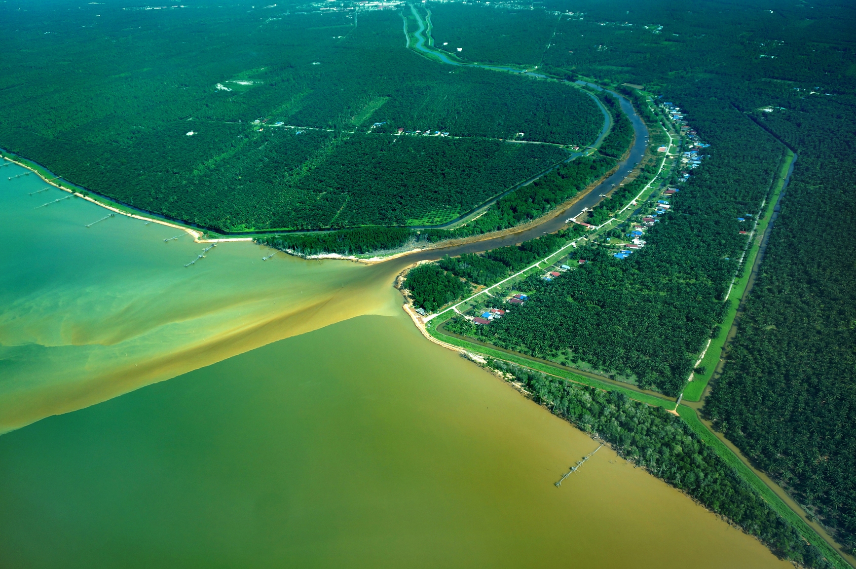
Chesapeake Bay, Virginia and Maryland, USA
The estuary picture above shows the river running into an ocean.
An estuary is a body of water that opens to an ocean or other body of saltwater. It is partially enclosed and fed by one or more rivers. All or part of the water in an estuary is brackish, a mixture of freshwater and saltwater. Separate zones of freshwater and saltwater may exist in parts of an estuary.
Estuaries are formed when the freshwater of a river meets the saltwater of an ocean in a partially enclosed area.
The size of an estuary depends on the size of the river or rivers that feed it, and the conditions of the land where water meets the ocean. An estuary can be less than a mile across or more than a hundred miles in length and width.
Where Can an Estuary Be Found?
An estuary can be found where a river meets the ocean or other body of saltwater in a partially enclosed area.
• San Francisco Bay, California, USA
• Chesapeake Bay, Virginia and Maryland, USA
• Thames Estuary, UK
• Río de la Plata, Uruguay and Argentina
• Gulf of Saint Lawrence, Canada
San Francisco Bay is an estuary that receives water from both the San Joaquin and Sacramento Rivers flowing from the Sierra Nevada Mountains. When including smaller bays of the estuary, San Francisco Bay is up to 60 miles long and 12 miles at its widest point with an average depth of only 12 to 15 feet.
It opens to the Pacific Ocean through the Golden Gate Strait under the famous Golden Gate Bridge. The bay is also famous for one of its five islands, Alcatraz, the site of a former high security federal prison and now a tourist site. Chesapeake Bay is the largest estuary of the US, collecting the waters of more than a dozen major rivers and draining in the Atlantic Ocean. The bay is 200 miles long and 30 miles wide at its widest point.
Mixtures of freshwater and saltwater in the bay support a large variety of aquatic life, and it is well known for harvesting crab and oysters. The Thames Estuary includes the Port of London and is the meeting point of the Thames River and the North Sea on the southeast coast of England. The Río de la Plata is a 180 mile long river that some people consider to be a gulf.
It is also a very large estuary that enters the South Atlantic Ocean between the coasts of Uruguay and Argentina. The world’s largest estuary is the Gulf of Saint Lawrence which meets the North Atlantic Ocean on the eastern Canadian coast. It is considered a partially enclosed inland sea with an average depth of almost 500 feet.
The Gulf is bordered by five different Canadian provinces and receives all water flowing from the Great Lakes through the St. Lawrence River, as well as water from 6 additional rivers.
A partially enclosed body of water fed by a river and open to the ocean or another body of saltwater
We want pictures and location of the lanforms around the world and we need your help. Click get started button below.

In Asia, China, India, Nepal, and Bhutan are home to one of the eight wonders of the world and one of the most beautiful mountains in the world, the Himalaya Mountains also called the Himalayas. Boasting as the world’s highest and most famous mountain peak, Mt. Everest. Within the verse of the ‘Kumarsambhava’, Sanskrit […]

Nature have provided us with fascinating landforms and features. The most often adored landforms are volcanoes. Like the perfect cone structure of Mayon Volcano in the Philippines or Mount Fiji in Japan, people look at their beauty and wonder with great appreciation to nature. Volcanoes are mountains with a very disastrous nature. Their only […]

Taal Volcano is the second most active volcano found in the province of Batangas. A complex volcano in the middle of Taal Lake and is often called an island within a lake, that is an island within a lake that is on an island as well as one of the lowest volcano in the […]

Mayon Volcano is one of the active volcanoes in the Philippines. Located in the southern part of Luzon about 473 kilometers (294 miles) from Makati Business District of the Philippines, Mount Mayon is the main landmark of the Province of Albay of Bicol Region. According to local folklore, the volcano was named after Daragang […]

The global temperature and weather is to a large extent a direct result of the sun’s effect to our planet. Together with the atmosphere and the rotation of the earth on its axis. The earth on which weather moves on has its own effect on the weather. The different landforms like mountains, volcanoes, plains, and the […]

