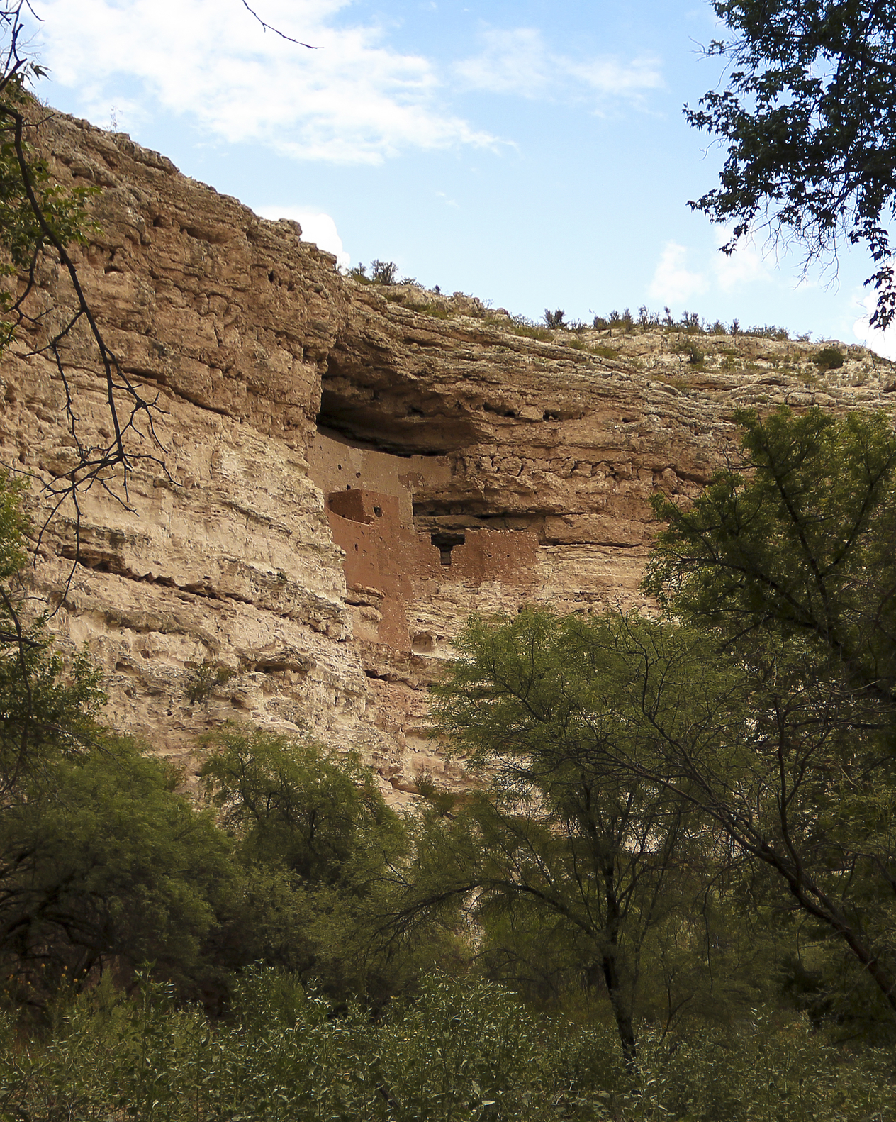
The geo picture above is of Montezuma Castle National Monument, Arizona, USA
A geo is an inward portion of a cliff face in the form of an narrow inlet or gully.
A geo is formed by the action of waves eroding the lower portion of a cliff. A depression or sea cave may form. The cliff face above the cave can erode and collapse over a period of time, creating a geo or extending the geo deeper into the cliff. Glacier movements can also cut depressions in steep rock formations that may erode to form a geo.
A geo can be from a few feet wide to several hundred feet in width.
Cliffs that meet the ocean or other large body of water usually have geo formations. Inland cliffs may also have geo formations that were created by wave action from a former body of water or a combination of glacier activity and erosion.
• Montezuma Castle National Monument, Arizona
• Ronda, Málaga Province, Spain
• Bunda Cliffs of the south Australian coast
The Sinagua people, a Native American Tribe of what is now Arizona, built a large cliff dwelling having 5 levels and 20 rooms. It can be seen within a geo formation that is now a national monument. The Montezuma Castle National Monument was mis-named, as the dwelling was built before Montezuma of the Aztec Nation was born by a different nation of people.
At the edge of vertical cliffs over 330 feet high, the city of Ronda overlooks the El Tajo Canyon in a mountainous region of the Spanish province of Málaga. The Guadalevín River runs through the canyon which divides the city in half.
The Bunda Cliffs on the south coast of Australia are part of the longest line of cliff formations in the world that extend for 120 miles and are more than 300 feet high in some areas. The Cliffs of Moher stand from 400 to 700 feet high on the coast of Ireland and receive thousands of visitors daily as the country’s most popular tourist destination.
A narrow portion of a cliff face in the form of an inlet or gully.
We want pictures and location of the lanforms around the world and we need your help. Click get started button below.

In Asia, China, India, Nepal, and Bhutan are home to one of the eight wonders of the world and one of the most beautiful mountains in the world, the Himalaya Mountains also called the Himalayas. Boasting as the world’s highest and most famous mountain peak, Mt. Everest. Within the verse of the ‘Kumarsambhava’, Sanskrit […]

Nature have provided us with fascinating landforms and features. The most often adored landforms are volcanoes. Like the perfect cone structure of Mayon Volcano in the Philippines or Mount Fiji in Japan, people look at their beauty and wonder with great appreciation to nature. Volcanoes are mountains with a very disastrous nature. Their only […]

Taal Volcano is the second most active volcano found in the province of Batangas. A complex volcano in the middle of Taal Lake and is often called an island within a lake, that is an island within a lake that is on an island as well as one of the lowest volcano in the […]

Mayon Volcano is one of the active volcanoes in the Philippines. Located in the southern part of Luzon about 473 kilometers (294 miles) from Makati Business District of the Philippines, Mount Mayon is the main landmark of the Province of Albay of Bicol Region. According to local folklore, the volcano was named after Daragang […]

The global temperature and weather is to a large extent a direct result of the sun’s effect to our planet. Together with the atmosphere and the rotation of the earth on its axis. The earth on which weather moves on has its own effect on the weather. The different landforms like mountains, volcanoes, plains, and the […]

