Horicon Marsh, northeastern Wisconsin, USA
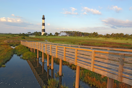
The marsh pictures above is in North Carolina
A marsh is a wetland that has primarily plant growth such as grasses, reeds, cattails and waterborn leaf plants and few or no trees.
Marshes can be formed by tides in lowland areas near a coast. Rivers often form marshlands on low lying floodplains and near lakes that flood during the wet season. Some marshes are seasonal and occur when the river is high, flooding grassland areas.
A marsh can be the size of a small lake. Marshlands can also extend for hundreds of square miles.
A marsh can be found in some low lying areas of coastline or a river delta. Freshwater marshes can be found in floodplains of some slow moving rivers. A lake may have marshland along its border.
• Horicon Marsh, northeastern Wisconsin, USA
• Okavango Delta, Botswana
• Florida Everglades, Florida, USA
A former glacier covered northeastern Wisonsin. Debris from the retreating glacier blocked the meltwater, forming a lake that accumulated sediment and eventually drained to form Horicon Marsh.
The area covers 32,000 acres and includes the Horicon Marsh State Wildlife Area and the Horicon National Wildlife Refuge with millions of migrating waterfowl that include duck species, Canadian geese, and great blue herons. The Okavango Delta, an area of 5,800 square miles, may be the world’s largest freshwater marsh.
The Okavango River of Botswana drains into a large delta which forms a marshland area of the Kalahari Desert. It is home for crocodiles and hippopotamuses, and a source of water for elephants, giraffes, wildebeast, lions, cheetahs and many other wild animals that live in the nearby desert.
The Florida Everglades are the largest freshwater marsh in the United States, covering over 2,000 square miles. The Everglades are actually a very wide, slow moving river averaging less than one foot in depth. Beginning at Lake Okeechobee, the land slopes very gradually toward the southwest.
Four major rivers of central Florida drain into the lake which overflows, the waters moving southwest through the Everglades to Florida Bay at a rate of one half mile per day. A large portion is sawgrass marshland, with areas of swampland and small clusters of cypress trees in places where sinkholes have developed in the limestone under the surface.
The Everglades are home for alligators and 16 wading bird species. There are white-tailed deer and marsh rabbits that are able to swim. Other animals include crocodiles, turtles, gray fox, raccoons, and bobcats. Manatee inhabit the waters near the coastline and are an endangered species with only about 2,000 living in Florida.
A wetland with waterborn grasses or other plants, having few or no trees.
Related to: Bayou
We want pictures and location of the lanforms around the world and we need your help. Click get started button below.

In Asia, China, India, Nepal, and Bhutan are home to one of the eight wonders of the world and one of the most beautiful mountains in the world, the Himalaya Mountains also called the Himalayas. Boasting as the world’s highest and most famous mountain peak, Mt. Everest. Within the verse of the ‘Kumarsambhava’, Sanskrit […]

Nature have provided us with fascinating landforms and features. The most often adored landforms are volcanoes. Like the perfect cone structure of Mayon Volcano in the Philippines or Mount Fiji in Japan, people look at their beauty and wonder with great appreciation to nature. Volcanoes are mountains with a very disastrous nature. Their only […]

Taal Volcano is the second most active volcano found in the province of Batangas. A complex volcano in the middle of Taal Lake and is often called an island within a lake, that is an island within a lake that is on an island as well as one of the lowest volcano in the […]

Mayon Volcano is one of the active volcanoes in the Philippines. Located in the southern part of Luzon about 473 kilometers (294 miles) from Makati Business District of the Philippines, Mount Mayon is the main landmark of the Province of Albay of Bicol Region. According to local folklore, the volcano was named after Daragang […]

The global temperature and weather is to a large extent a direct result of the sun’s effect to our planet. Together with the atmosphere and the rotation of the earth on its axis. The earth on which weather moves on has its own effect on the weather. The different landforms like mountains, volcanoes, plains, and the […]

