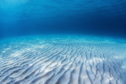
The oceanic basin picture above is only a small part of the Atlantic Ocean Basin
An oceanic basin is the land surface under an ocean that includes the various topography below the water.
This includes the continental shelf, abyssal plain, mid-ocean ridge and other formations that may exist on the seafloor. Another definition of an oceanic basin refers specifically to the abyssal plain that lies between higher formations such as a continental shelf and mid-ocean ridge.
An ocean basin is formed when water has covered a large portion of the Earth’s crust. In the distant past, this may have happened when there was an increase in available water, or a fall of landmass. Over a long period of time, an oceanic basin can be created by the spreading of the seafloor and the movement of tectonic plates. The Atlantic Ocean Basin as it exists today was created over millions of years, as the continents of Europe, Africa and America separated, riding on tectonic plates.
An oceanic basin is equal in size to the ocean above. The Pacific Ocean Basin is large enough to hold the land mass of all seven continents.
An oceanic basin can be found below an ocean.
• Atlantic Ocean Basin
• Indian Ocean Basin
• Arctic Ocean Basin
• Pacific Ocean Basin
The Atlantic Ocean Basin covers approximately 29 million square miles of the Earth’s surface, extending from the Arctic Ocean in the north, to the Southern Ocean above Antarctica. The average depth of the basin is 12,881 feet and the deepest point is the Puerto Rico Trench at 28,231 feet below the water.
The Indian Ocean Basin has 26 million square miles of underwater land surface, bordered by Africa in the west, Australia in the east, India to the north and the Southern Ocean. The basin has an average depth of 13,800 feet, and the deepest point is 23,812 feet below water in the Java Trench.
The Southern Ocean was officially designated by the International Hydrographic Organization in the year 2000, but does not have a true ocean basin. It surrounds the continent of Antarctica and extends northward to 60 degrees of latitude, where it meets the Atlantic, Indian and Pacific Oceans.
The Arctic Ocean Basin has over 5 million square miles, Approximately one third of this is the continental shelves of North America and Asia. It has an average depth of 4,900 feet and the deepest point is at 17,880 feet below water. The Pacific Ocean Basin is the largest oceanic basin in the world with an area of 59 million square miles.
It is also the deepest, with an average depth of 14,042 feet. The deepest point found below sea level is the Marianas Trench in the western Pacific, near the Marianas Islands to the west. In a depression called the Challenger Deep within the trench, a depth of approximately 36,070 feet has been measured, a distance of almost 7 miles below the surface.
The land surface under an ocean, including all of its topographical features
We want pictures and location of the lanforms around the world and we need your help. Click get started button below.

In Asia, China, India, Nepal, and Bhutan are home to one of the eight wonders of the world and one of the most beautiful mountains in the world, the Himalaya Mountains also called the Himalayas. Boasting as the world’s highest and most famous mountain peak, Mt. Everest. Within the verse of the ‘Kumarsambhava’, Sanskrit […]

Nature have provided us with fascinating landforms and features. The most often adored landforms are volcanoes. Like the perfect cone structure of Mayon Volcano in the Philippines or Mount Fiji in Japan, people look at their beauty and wonder with great appreciation to nature. Volcanoes are mountains with a very disastrous nature. Their only […]

Taal Volcano is the second most active volcano found in the province of Batangas. A complex volcano in the middle of Taal Lake and is often called an island within a lake, that is an island within a lake that is on an island as well as one of the lowest volcano in the […]

Mayon Volcano is one of the active volcanoes in the Philippines. Located in the southern part of Luzon about 473 kilometers (294 miles) from Makati Business District of the Philippines, Mount Mayon is the main landmark of the Province of Albay of Bicol Region. According to local folklore, the volcano was named after Daragang […]

The global temperature and weather is to a large extent a direct result of the sun’s effect to our planet. Together with the atmosphere and the rotation of the earth on its axis. The earth on which weather moves on has its own effect on the weather. The different landforms like mountains, volcanoes, plains, and the […]

