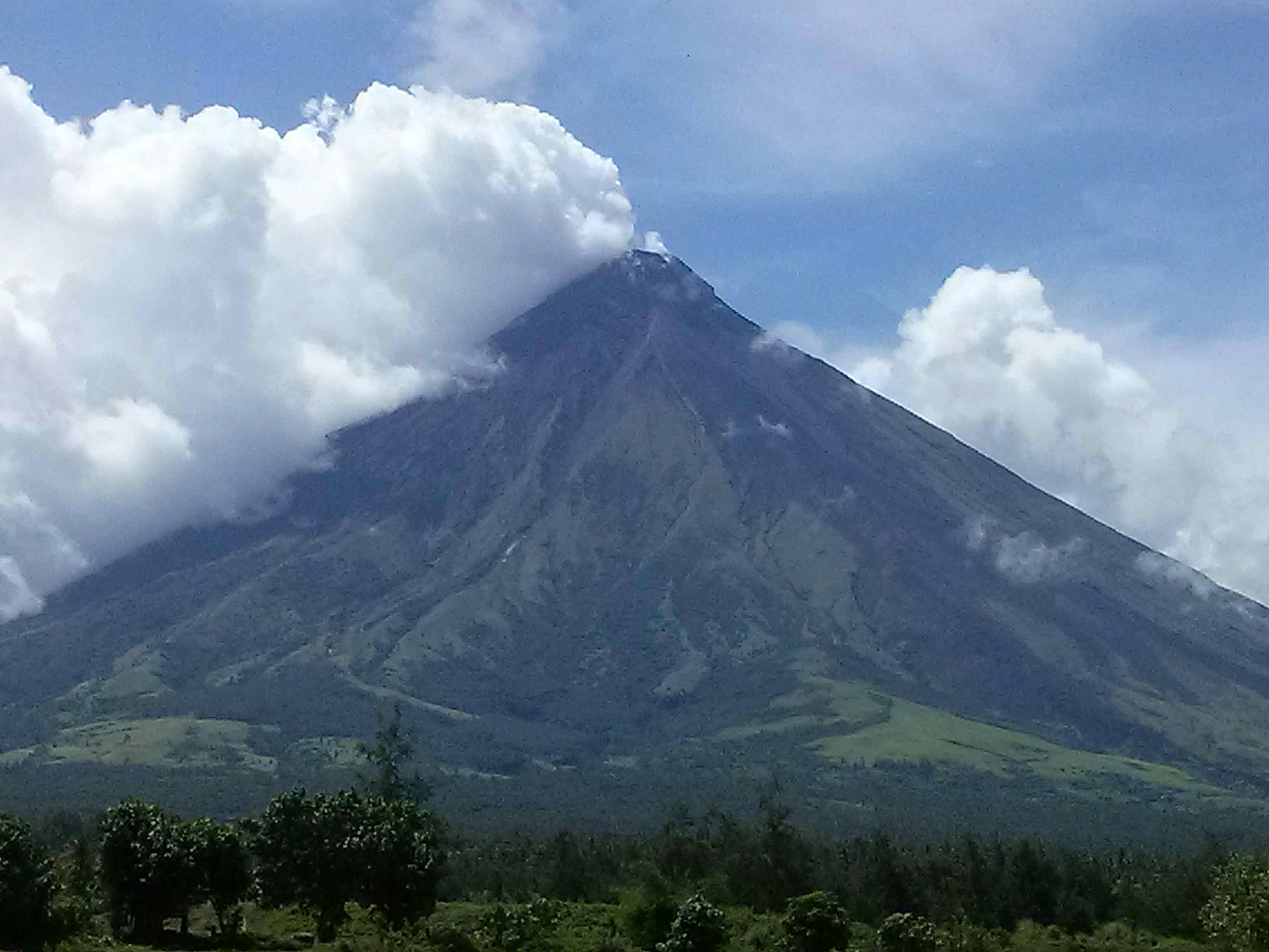
Mayon Volcano is one of the active volcanoes in the Philippines. Located in the southern part of Luzon about 473 kilometers (294 miles) from Makati Business District of the Philippines, Mount Mayon is the main landmark of the Province of Albay of Bicol Region.
According to local folklore, the volcano was named after Daragang Magayon (Beautiful Lady in English translation), a legendary heroine whose kindness and beauty is well known.
Mayon Volcano is a Stratovolcano composite type volcano renowned for its perfect cone shape, can be seen in all eight cities and municipalities of Albay. With a height of 8,077 feet or 2,462 metres, it is the highest point of the province and was declared the first national park of the Philippines on July 20, 1938 and was reclassified a Natural Park named Mayon Volcano Natural Park in the year of 2000. Rocks around Mayon Volcano was aged more than 20 million years old.
The perfect shape was formed through layers of lava flows and pyro plastic surges from erosion and past eruptions. It has a small crater and the upper slopes are steep with an average of 35 to 40 degrees. Being part of the Pacific Ring of Fire, movement on oceanic plates can trigger an eruption. One example of such big eruption happened February 2000 where more than 4000 families lost their homes.
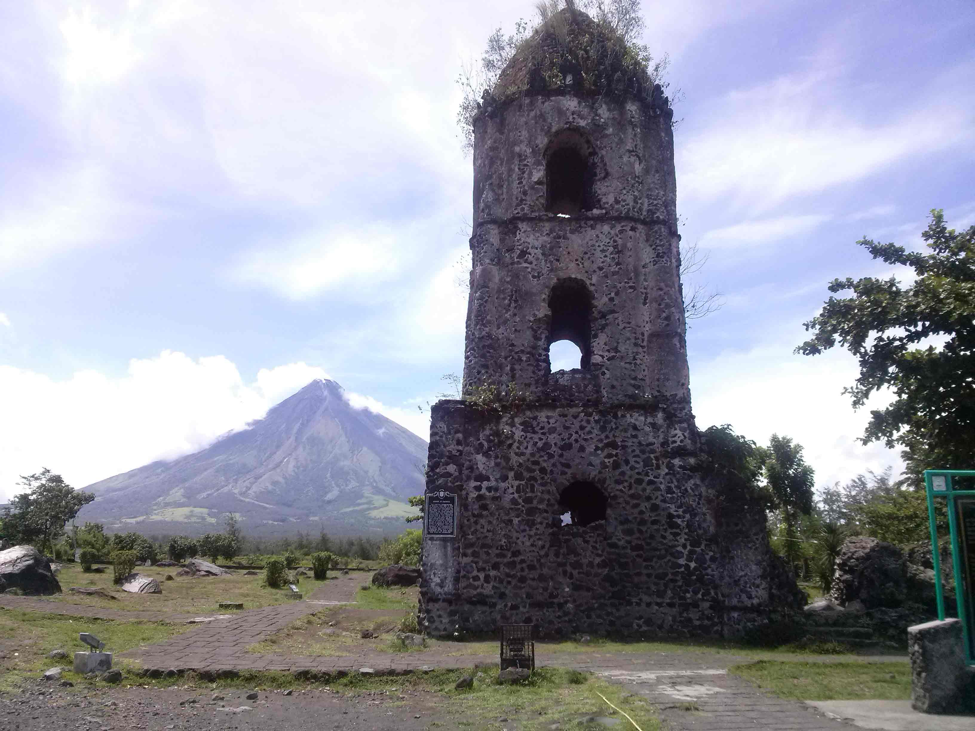
Cagsawa Ruins Near Mayon Volcano
Mayon Volcano erupted 49 times in the last 400 years. The first major eruption that was recorded was February 1616. Year 1814 eruption destroyed Cagsawa Church where you can only see the bell tower today. The congregation of Cagsawa Church sought refuge and transferred to Daraga Church located on a hill facing Mayon Volcano. This is the most lethal eruption captured in history where 2,200 people perished and town of Cagsawa got buried beneath 30 feet (9 metres) of ash. The longest eruption happened June 23, 1897 that lasted for seven (7) days. Lava flowed the Mayon slopes and rained fire which destroyed trees, rivers and streams around the volcano.
History shows that the last volcano eruption happened September 18, 2014.
To date, Mayon Volcano is a tourist destination for the province aside from its local delicacies, chili ice cream, pili nuts and watching whale sharks.
We want pictures and location of the lanforms around the world and we need your help. Click get started button below.

In Asia, China, India, Nepal, and Bhutan are home to one of the eight wonders of the world and one of the most beautiful mountains in the world, the Himalaya Mountains also called the Himalayas. Boasting as the world’s highest and most famous mountain peak, Mt. Everest. Within the verse of the ‘Kumarsambhava’, Sanskrit […]

Nature have provided us with fascinating landforms and features. The most often adored landforms are volcanoes. Like the perfect cone structure of Mayon Volcano in the Philippines or Mount Fiji in Japan, people look at their beauty and wonder with great appreciation to nature. Volcanoes are mountains with a very disastrous nature. Their only […]

Taal Volcano is the second most active volcano found in the province of Batangas. A complex volcano in the middle of Taal Lake and is often called an island within a lake, that is an island within a lake that is on an island as well as one of the lowest volcano in the […]

Mayon Volcano is one of the active volcanoes in the Philippines. Located in the southern part of Luzon about 473 kilometers (294 miles) from Makati Business District of the Philippines, Mount Mayon is the main landmark of the Province of Albay of Bicol Region. According to local folklore, the volcano was named after Daragang […]

The global temperature and weather is to a large extent a direct result of the sun’s effect to our planet. Together with the atmosphere and the rotation of the earth on its axis. The earth on which weather moves on has its own effect on the weather. The different landforms like mountains, volcanoes, plains, and the […]

