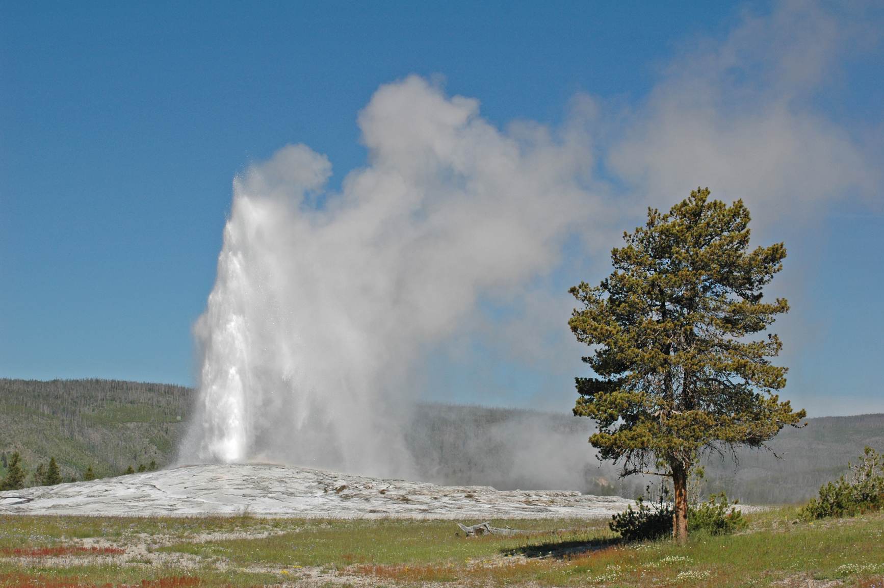
The geyser picture is of Old Faithful, Yellowstone National Park, Wyoming, USA
A geyser is an opening in the ground that occasionally or regularly discharges water and steam.
When ground water enters an area of geothermal activity below the ground, this can produce steam. The pressure generated from steam can force groundwater to the surface. If an narrow opening is available, water and steam may be ejected. When all the water has turned to steam, the pressure drops and the eruption stops.
Geysers are usually measured by the height of an eruption. Most famous geysers reach at least 100 feet high during a major eruption. The highest recently active geysers can reach over 300 feet. The highest known geyser in history was Waimangu Geyser of New Zealand which erupted from 1900 to 1904. The tallest eruptions of Waimangu were estimated at over 1500 feet in height.
Over one thousand active geysers can be found in the world. They occur in areas of volcanic activity that have pockets of magma deep underground, often near a fault line. The single most active area for geysers is Yellowstone National Park in Wyoming. It has an average of 465 active geysers each year.
• Strokkur, Iceland
• Old Faithful, Yellowstone National Park, Wyoming, USA
• Grand Geyser of Yellowstone
• Great Geysir, Iceland
• Steamboat Geyser of Yellowstone
Strokkur is a geyser in Iceland that erupts every few minutes. Old Faithful in Yellowstone National Park is the most famous geyser in the US, which erupts regularly every 65 to 90 minutes and reaches up to 185 feet in height. The tallest predictable geyser in the world is Grand Geyser, also in Yellowstone, which erupts for up to 10 minutes twice daily reaching up to 200 feet.
Great Geysir or Geysir of Iceland has been considered to be the world’s tallest geyser in recent years. In the year 2000 after an earthquake it erupted several times to almost 400 feet in height. However, some say that Geysir is now dormant. Although Steamboat Geyser in Yellowstone National Park erupts only occasionally with intervals of up to 50 years, there were 2 recent major eruptions in 2013 and 2014 that were more than 300 feet high.
A narrow opening in the ground that ejects hot water and steam intermittently
We want pictures and location of the lanforms around the world and we need your help. Click get started button below.

In Asia, China, India, Nepal, and Bhutan are home to one of the eight wonders of the world and one of the most beautiful mountains in the world, the Himalaya Mountains also called the Himalayas. Boasting as the world’s highest and most famous mountain peak, Mt. Everest. Within the verse of the ‘Kumarsambhava’, Sanskrit […]

Nature have provided us with fascinating landforms and features. The most often adored landforms are volcanoes. Like the perfect cone structure of Mayon Volcano in the Philippines or Mount Fiji in Japan, people look at their beauty and wonder with great appreciation to nature. Volcanoes are mountains with a very disastrous nature. Their only […]

Taal Volcano is the second most active volcano found in the province of Batangas. A complex volcano in the middle of Taal Lake and is often called an island within a lake, that is an island within a lake that is on an island as well as one of the lowest volcano in the […]

Mayon Volcano is one of the active volcanoes in the Philippines. Located in the southern part of Luzon about 473 kilometers (294 miles) from Makati Business District of the Philippines, Mount Mayon is the main landmark of the Province of Albay of Bicol Region. According to local folklore, the volcano was named after Daragang […]

The global temperature and weather is to a large extent a direct result of the sun’s effect to our planet. Together with the atmosphere and the rotation of the earth on its axis. The earth on which weather moves on has its own effect on the weather. The different landforms like mountains, volcanoes, plains, and the […]

