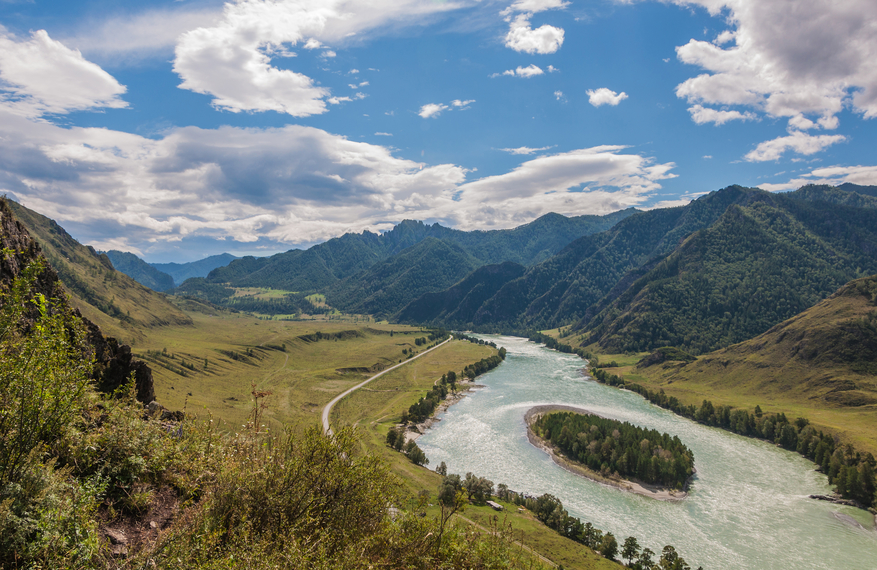
Example of a River Island Landform:
Davis Island, Mississippi River, Louisiana and Mississippi, USA
The river island picture above is of a river in a mountainous area.
A river island is any kind of landmass within a river that sits above water. It may be an Island, a sand bar or a rock.
Sand or other sediment can build in a portion of the river by currents when the river level is high. During the dry season, these can be exposed above the surface. Erosion of the river bed or river bank can reduce the water level, exposing a rock or landmass near the surface. An anabranch can also form and return to the main portion of the river downstream, forming an island between two channels of the river.
A river island can as small as a rock above the surface, or as large as an island covering more than a hundred square miles.
A river island can be found in a river or stream above the water.
• Davis Island, Mississippi River, Louisiana and Mississippi, USA
• Montreal Island, Quebec, Canada
• Manhattan Island, New York, USA
• Chongming Island, Yangtze River, China
Davis Island of the Mississippi River is in Warren county, Mississippi and also Madison Parish of Louisiana. It covers about 120 square miles, which can vary depending on the level of the river. Davis Island was the location of a plantation owned by President Jefferson Davis of the Confederate States.
The city of Montreal, Canada sits entirely on a river island of approximately 200 square miles in the St. Lawrence River of Quebec. A few independently incorporated suburban towns also occupy a portion of the island. Manhattan Island lies between the Hudson and East Rivers and is a borough of New York City that includes the well known areas of Central Park and Times Square.
The island covers 22.7 square miles and is famous for the original sale of the island to Dutch colonists by native Americans. Sold for the equivalent of 24 dollars, the value of the island is now estimated to be over 3 trillion dollars. Chongming Island in China covers nearly 500 square miles and has a length of about 50 miles.
It was formed at the entrance of the Yangtze River by the buildup of sediment. The island includes a bird sanctuary, the Dongping National Forest and a Buddhist site called Jin´ao Mountain with beautiful Chinese gardens that attract many visitors.
An island in a river.
We want pictures and location of the lanforms around the world and we need your help. Click get started button below.

In Asia, China, India, Nepal, and Bhutan are home to one of the eight wonders of the world and one of the most beautiful mountains in the world, the Himalaya Mountains also called the Himalayas. Boasting as the world’s highest and most famous mountain peak, Mt. Everest. Within the verse of the ‘Kumarsambhava’, Sanskrit […]

Nature have provided us with fascinating landforms and features. The most often adored landforms are volcanoes. Like the perfect cone structure of Mayon Volcano in the Philippines or Mount Fiji in Japan, people look at their beauty and wonder with great appreciation to nature. Volcanoes are mountains with a very disastrous nature. Their only […]

Taal Volcano is the second most active volcano found in the province of Batangas. A complex volcano in the middle of Taal Lake and is often called an island within a lake, that is an island within a lake that is on an island as well as one of the lowest volcano in the […]

Mayon Volcano is one of the active volcanoes in the Philippines. Located in the southern part of Luzon about 473 kilometers (294 miles) from Makati Business District of the Philippines, Mount Mayon is the main landmark of the Province of Albay of Bicol Region. According to local folklore, the volcano was named after Daragang […]

The global temperature and weather is to a large extent a direct result of the sun’s effect to our planet. Together with the atmosphere and the rotation of the earth on its axis. The earth on which weather moves on has its own effect on the weather. The different landforms like mountains, volcanoes, plains, and the […]

