Example of a Continental Shelf Landform:
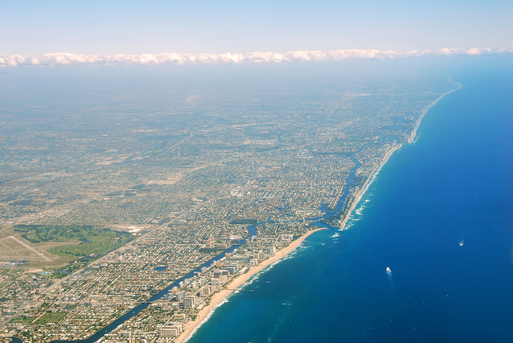
Land that extends from a continent under the ocean is called a continental shelf. A shelf is not very deep, when compared to ocean depths beyond. A continental shelf is usually less than 500 feet below the ocean’s surface.
Part of a continent may drop in elevation, becoming a portion of continental shelf that borders the dry mainland. The sea level can also rise, submerging a portion of the continent. Part of a shelf can also rise above the water and become part of the continent, or the sea level may drop and expose a part of the shelf. These events have taken place at certain times in the distant past, according to some geologists.
A continental shelf can be found bordering most continental coastlines. The shelf is actually a portion of the continent that lies below sea level. Certain areas of a continental coast have no shelf. These usually occur where there is a meeting of tectonic plates at the coastline. The coast of Chile is one example of this.
The average width of a continental shelf beyond the coastline is 50 miles. The largest continental shelf lies off the Siberian coast in the Arctic Ocean, extending for 930 miles into the ocean.
North Sea
South China Sea
Persian Gulf
The North Sea that borders the northern European and Scandinavian countries is a shallow sea that lies above the continental shelf of Europe with an average depth of 300 feet. The South China Sea covers a large shelf that includes Sumatra, Java, Borneo and the Asian mainland. In many areas its depth is only about 65 feet. The Persian Gulf lies over a shelf that averages 164 feet below the surface.
The extended landmass of a continent that lies below the ocean at a shallow depth
We want pictures and location of the lanforms around the world and we need your help. Click get started button below.

In Asia, China, India, Nepal, and Bhutan are home to one of the eight wonders of the world and one of the most beautiful mountains in the world, the Himalaya Mountains also called the Himalayas. Boasting as the world’s highest and most famous mountain peak, Mt. Everest. Within the verse of the ‘Kumarsambhava’, Sanskrit […]

Nature have provided us with fascinating landforms and features. The most often adored landforms are volcanoes. Like the perfect cone structure of Mayon Volcano in the Philippines or Mount Fiji in Japan, people look at their beauty and wonder with great appreciation to nature. Volcanoes are mountains with a very disastrous nature. Their only […]

Taal Volcano is the second most active volcano found in the province of Batangas. A complex volcano in the middle of Taal Lake and is often called an island within a lake, that is an island within a lake that is on an island as well as one of the lowest volcano in the […]

Mayon Volcano is one of the active volcanoes in the Philippines. Located in the southern part of Luzon about 473 kilometers (294 miles) from Makati Business District of the Philippines, Mount Mayon is the main landmark of the Province of Albay of Bicol Region. According to local folklore, the volcano was named after Daragang […]

The global temperature and weather is to a large extent a direct result of the sun’s effect to our planet. Together with the atmosphere and the rotation of the earth on its axis. The earth on which weather moves on has its own effect on the weather. The different landforms like mountains, volcanoes, plains, and the […]

